How to Use

How to Search for Data?

Read and Interact with the Dataset Detail Page
-
Dataset Title and Abstract
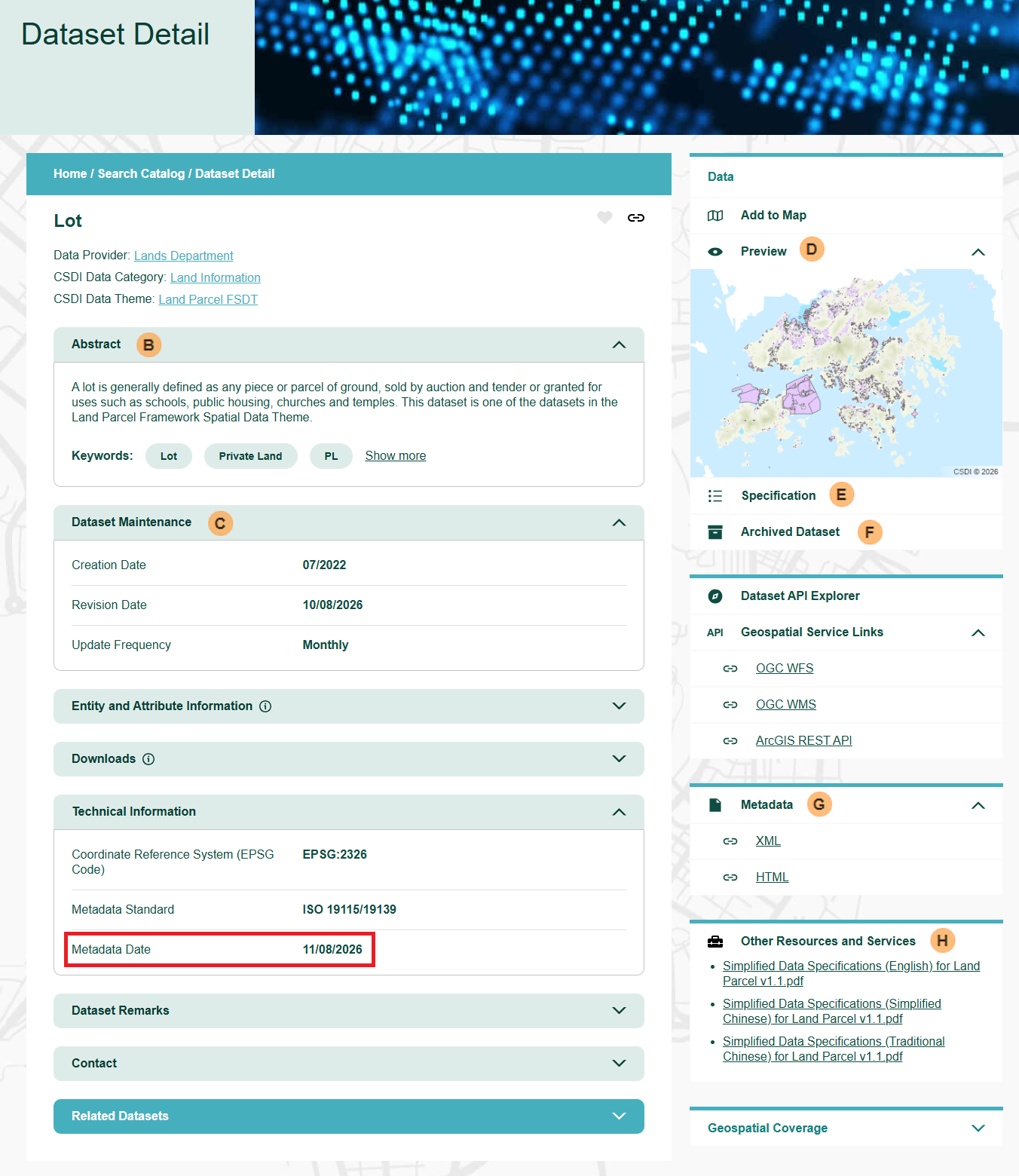
Read the Dataset Title and Abstract to see if it is what you are looking for.
-
Dataset Maintenance
Check the Creation Date, Revision Date, Update Frequency, and Metadata Date to see if it fits your application.
- Creation Date: Date when the dataset was brought into existence.
- Revision Date: Date when the dataset was improved or amended.
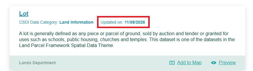
- Metadata Date: The date when the metadata was created or updated, which also represents the date the dataset was published on the CSDI Portal. This date is displayed for each dataset in the Search Catalog.
-
Map Preview
Check the Map Preview to get a quick view of what the dataset looks like.
-
Specification
You can view the specification of the source data here. It provides data layers, entity descriptions, and domain to help you understand and use the data.
-
Archived Dataset
Here you can access previous versions of the dataset. The archive retains only the most recent 3 years of data, organised by quarter (e.g., 2026 Q.2, 2026 Q.1, 2025 Q.3). If a quarter shows "Not available", it means no archived version exists for that period.
-
Metadata
View the dataset's metadata in HTML or XML format. HTML provides a human‑readable webpage, while XML offers a machine‑readable structure.
-
Other Resources and Services
Here you can explore other resources and services related to the dataset.
-
Entity and Attribute Information
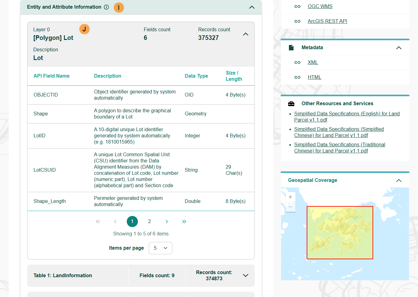
You can view all the layers, tables, field counts, and record counts available in the datasets.
-
Entity and Attribute Information (Contents)
Click on a Layer or Table item to view the list of attributes if you want to understand the data structure for Dataset API or for using the published dataset in FGDB format.
- Notes: The Entity and Attribute Information displayed here is extracted from the dataset in FGDB format. Please be aware that the Data Type, API Field Name, and field ordering may differ from the original source. You may go to the Specfications page to learn more about the structure of the source dataset.
-
Download
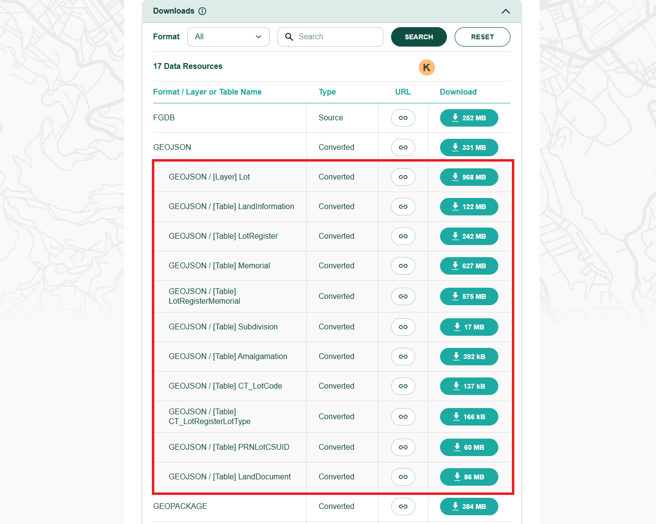
You can choose from the available formats to download either the source data or converted data – whichever best fits your application.
Click Download button to directly download the ZIP files, or click the URL button to copy their download link.
You can access also unzipped versions of individual feature layers or tables in the GeoJSON format. (see highlighted area)
- Tip: Use the Download button for direct file download to your computer. Use the URL button to copy URLs for programming and sharing.
- Notes: The converted data may exhibit variations in data types, field ordering, and naming conventions compared to the source data.
Preview and Interact with a Spatial Dataset
-
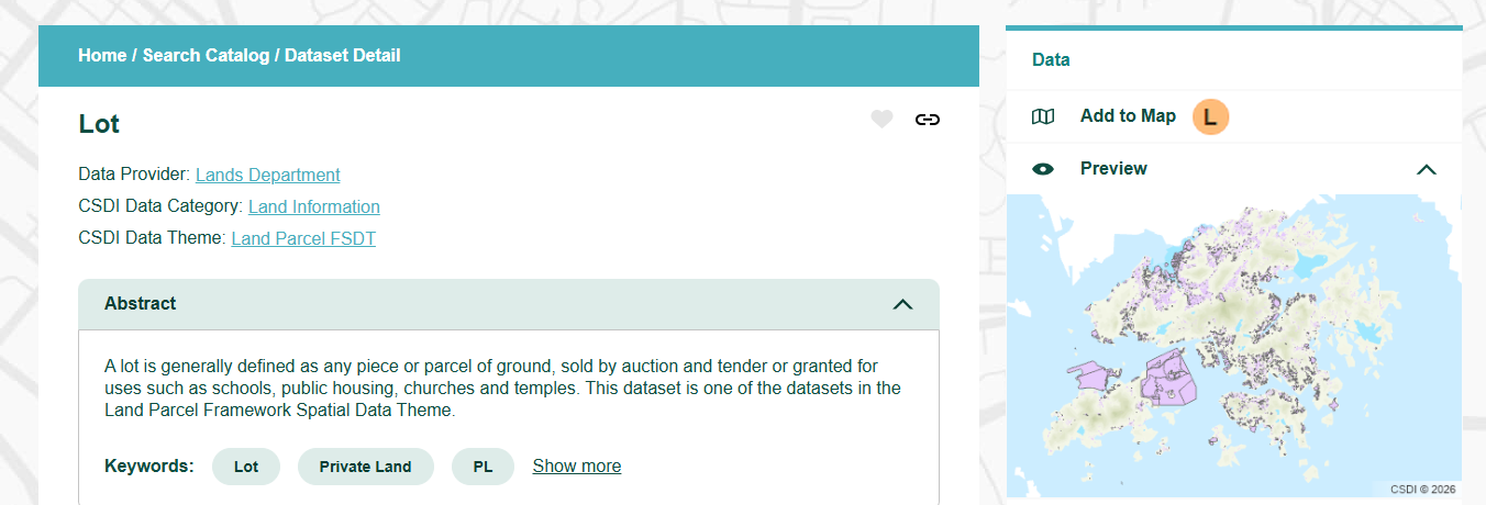
Add to Map
To view the map details, click Add to Map and you can open the dataset using the interactive Map Viewer.
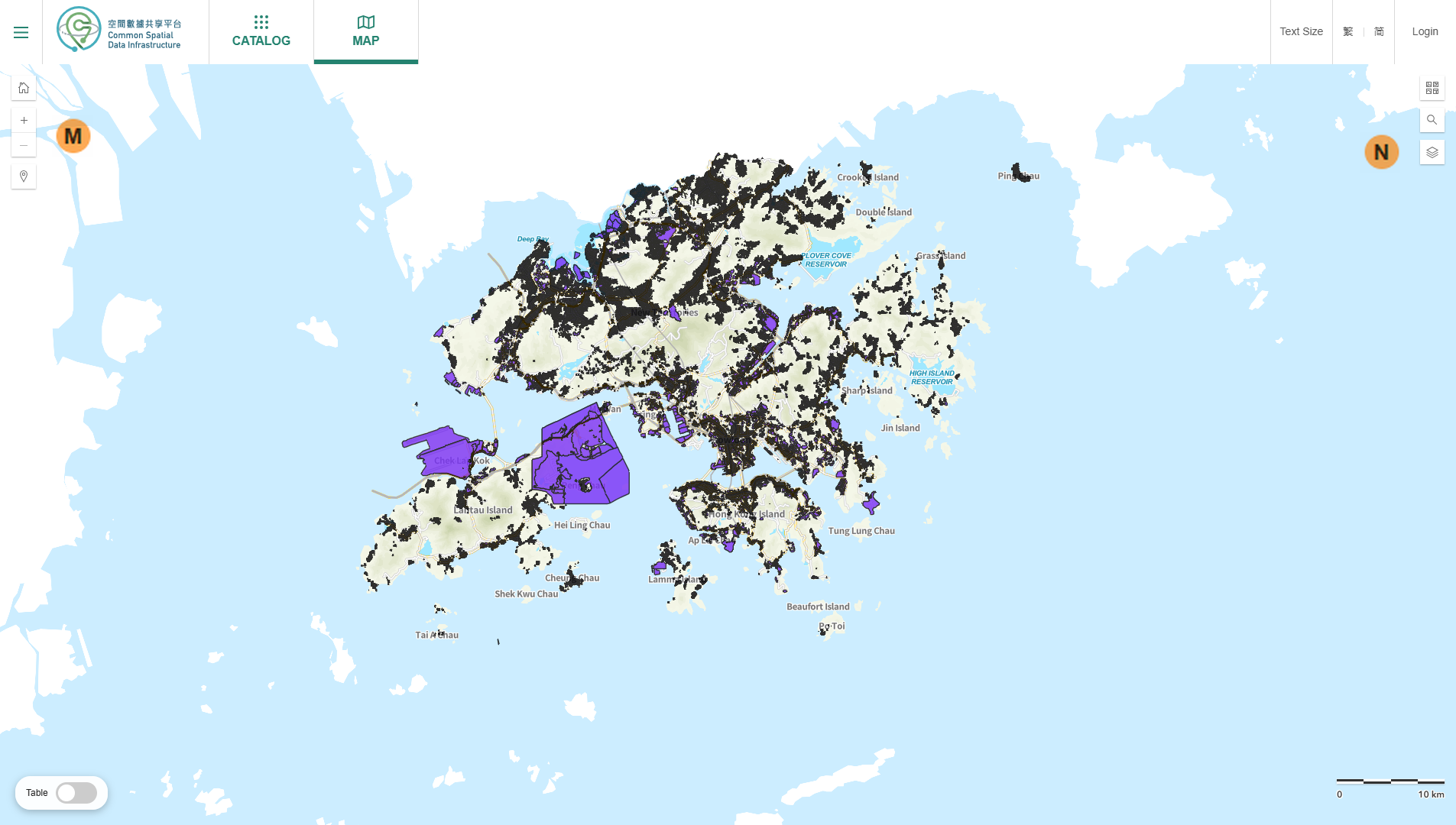
-
Navigation Functions
A set of map navigation functions are available at the left‑hand side. You can:
- Return to the default view
- Zoom in and out
- Search for a location
- Rotate the map by holding the right mouse button and moving your mouse
- “Return to North” button to reset the map to a north‑up orientation
-
Advanced Tools
The following supplementary mapping tools are located on the right-hand side.
- Basemap: Switch between provided base maps.
- Catalog Search: Search and add other datasets directly.
- Layer List: View and edit all added layers, and allow to switch on/off map labels.
Using Geospatial Services to Access the Dataset
-
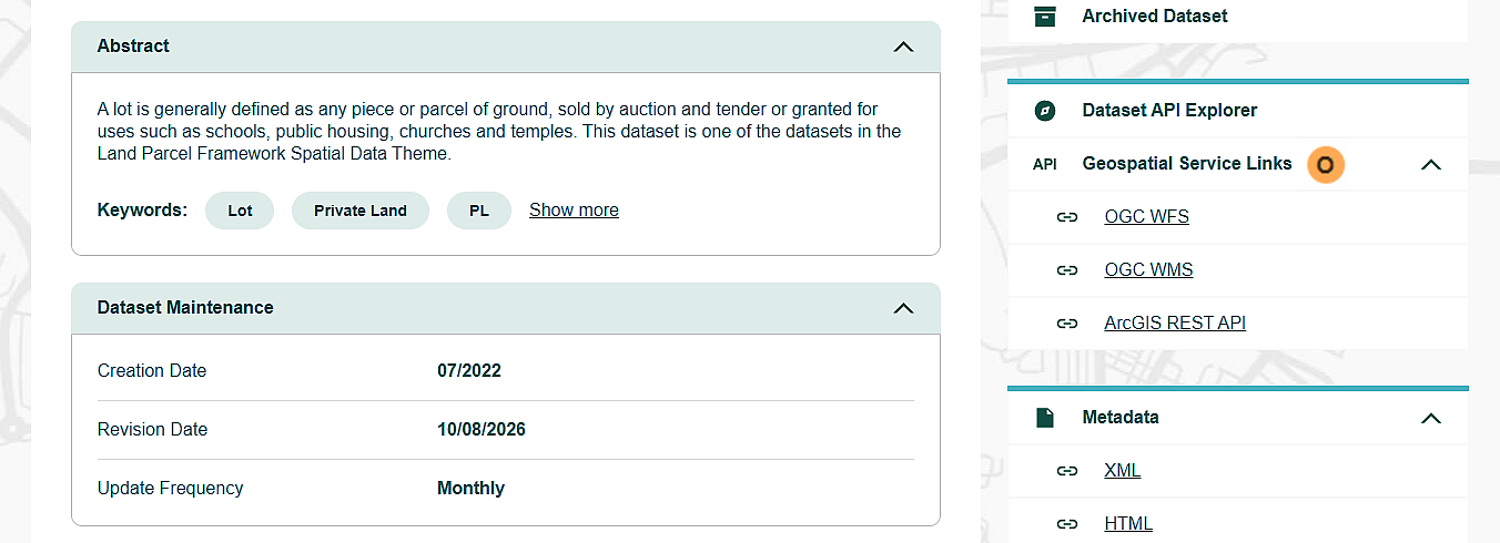
Geospatial Service
You can access the dataset directly via APIs for seamless integration into your applications. We provide three APIs for your selection:
- OGC Web Feature Service (OGC WFS)
- OGC Web Map Service (OGC WMS)
- ArcGIS REST API (ARCGIS)
Select your preferred service to copy a query string and you can paste the string into your web browser to view the service capabilities.
For details, please go to this page