en
How to Use

How to find a dataset?
- You can enter keywords such as “Building” in the search bar. The Search Bar will return all possible datasets and data providers. Select the item that best fits what you are looking for to open the dataset detail page or list of datasets
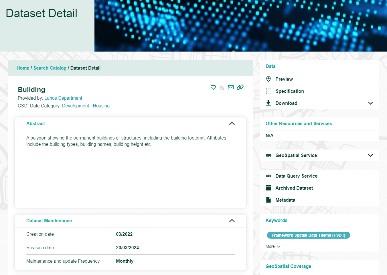
Read and interact with the Dataset Detail page
- Read the Dataset Title and Abstract to see if it is what you are looking for
- Check the Creation date, Revision date, Maintenance and update frequency to see if it fits your application
- Click “Specifications” button to open the data specification for details if you like to understand the data structure.
- Click “Download” to check out what formats are available for the dataset. Choose the format that suits to your application to download the entire dataset.
Preview a spatial dataset
- You can click “Preview” button to browse the dataset on the Map.
- To move around the map, you can use your mouse to zoom in/out and pan the map by mouse or click navigation buttons on the Map.
- To see what attributes are available, you can click a dataset feature to open a attribute list.
- Click the “Back” button to return to the Dataset Detail page.
Access the dataset using our Geospatial Services
-
You can access the dataset using our Geospatial Services aka Dataset APIs.
There are three APIs for your selection:
- Web Feature Service (WFS)
- Web Map Service (WMS)
- ArcGIS REST API (ARCGIS)
Click either one to copy the query string and paste it to the web browser to see the service capabilities.
For details, please go to this page


